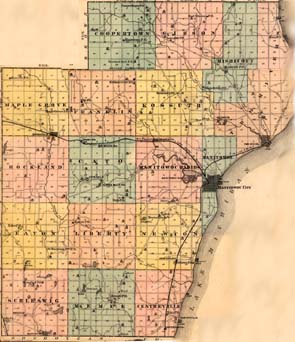
This is to help people know where the townships as well as the sections are in relationship to one another.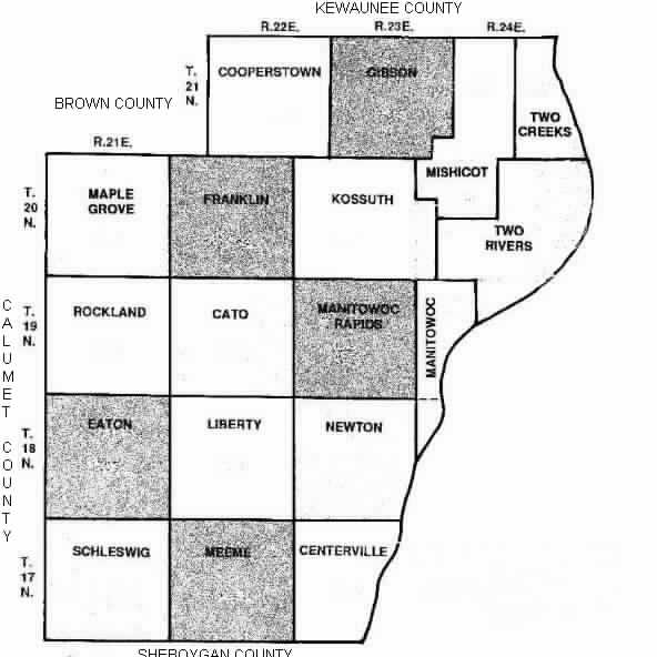
TOWNSHIP SECTIONS Each section is 1 square mile in size. _____ _____ _____ _____ _____ _____ | | | | | | | | 6 | 5 | 4 | 3 | 2 | 1 | |_____|_____|_____|_____|_____|_____| | | | | | | | | 7 | 8 | 9 | 10 | 11 | 12 | |_____|_____|_____|_____|_____|_____| | | | | | | | | 18 | 17 | 16 | 15 | 14 | 13 | |_____|_____|_____|_____|_____|_____| | | | | | | | | 19 | 20 | 21 | 22 | 23 | 24 | |_____|_____|_____|_____|_____|_____| | | | | | | | | 30 | 29 | 28 | 27 | 26 | 25 | |_____|_____|_____|_____|_____|_____| | | | | | | | | 31 | 32 | 33 | 34 | 35 | 36 | |_____|_____|_____|_____|_____|_____|